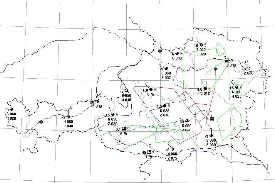
TBK is a Java program for automatic generation of weather charts, where METAR and SYNOP bulletins are represented as weather stations in a geographical map.
Program features:
| The station model includes clouds (amount and height), visibility, weather phenomena, wind speed and direction. | |
| The configuration of the stations is read from a simple stationlist (text file), where identifiers and geographical position for each station are defined. | |
| Geographical overlays can be configured as well. | |
| Program can be used without user interaction: after starting the program, the most current data for all configured stations is retrieved from a database, the chart is created, printed and/or saved as gif-file. | |
| An optional print preview (including printer selection) is possible. | |
| Runs on all computer platforms which support the Java2 run-time environment, for example: Windows, Sun/Solaris, Compaq/Digital Unix, IBM/AIX, Linux etc. |
For more informations, please contact us.
The following image shows an example for such a chart.
